At Gaist, we are experts in collecting and analysing data for all our customers.
Gaist has developed its unique, repeatable, detailed and auditable highways surveying over the last 12 years. Our ongoing research and high quality systems are some of the most advanced of their kind in the United Kingdom and overseas.
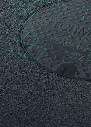
Our surveys can be used to provide an accurate detailed map layout of the whole roadscape environment – including full and part detailed network condition maps. We provide carriageway and footway condition maps, bridges, lighting columns, utilities, drainage, other ironworks, road markings, as well as other infrastructure assets.
Our patented approach allows us to provide data to an unparalleled level of detail which is being adopted by a rapidly growing number of Asset Managers, Highways Engineers and utilities companies. We collect over 35 different defect types commonly and not so commonly found on the highways. Our Footway condition surveys are accurate, detailed and provide our customers with key information to plan repairs. We can also supplement this information with profiling technology or blend with other geometry based systems.
Understanding condition, location and value of roadscape assets is critical for any Asset Manager. We can collect above ground assets from the entire roadscape environment, from the smallest road stud to larger physical assets. We help our clients understand the infrastructure environment and provide this in clear location maps that reflect imagery.
We can make data available in many different ways and can be connected to any Asset Management System or GIS via an API, allowing any organisation to access the data with nothing more than an internet connection.
Organisations that can benefit from our inventory data include highway authorities, utility companies, mapping agencies, consultants, design agencies and road maintenance companies. All of whom can use the highly detailed map we provide of the carriageways and footways for tasks such as: inventory collection, planning, design work, traffic management, road markings, estimations, traffic regulation orders, parking restrictions, work planning and the delivery of other highway functions.
We can also undertake individual and bespoke data inventory collection as required.
Working closely with Highways Authorities and Highways Contractors, Gaist uses a range of advanced tools that have been continually developed over years of experience of working with a range of highway authorities.
We work closely with our customers Highways Engineers to build the identification process taking in smaller detailed condition data areas and calculating optimal schemes by combining them in to larger areas that meet the given scheme criteria. We work with other types of data as well as our condition data – for example, SCRIM and SCANNER.
We use a sophisticated standard set of algorithms, which can also be customised to reflect local policies, maintenance treatments and criteria – making this truly tailored to our customers’ needs
Our algorithms estimate the costs of each scheme, based on customers unit rates for each type of maintenance. This produces options for highways engineers to further refine and rank maintenance schemes based on any additional local priorities.
A. CARRIAGEWAYS
B. FOOTWAYS
Good lifecycle planning supports strategic level planning and better decision making for future highway investment decisions. By considering an asset over a whole life cycle, it is possible to select the optimum point to intervene with the optimum treatment. Planning and estimating expenditure requirements alongside long-term asset performance is essential if future roads and services, including utility works, are to improve. These estimates can be used to determine the likely performance of the asset so that future budget can be prioritised accordingly.
At Gaist, we are experts in the use of advanced regression methods to calibrate models which allows us to use high quality condition data that we have collected to help you understand infrastructure performance and to ensure that the deterioration models validate well against local needs and priorities.
Our technology gives you the flexibility to develop a range of probability based models calibrated from real-world data that reflects the highly complex and variable patterns of deterioration found in local road networks.
Our deterioration models can be readily calibrated from historical data on condition and maintenance data. The models can quantify the changing risk of deterioration with time since last maintenance as well as the risks associated more closely with environmental conditions such as drainage or subsurface issues. We can also combine this with your organisations risk based approach to ensure that you are making the right decision at the right time to ensure funding can go further.
The HM Treasury Whole of Government Accounts (WGA) policy has been introduced in recent years. WGA aims to develop a common set of accounting policies across the whole of the public sector. Through this approach, WGA has set requirements for the way the value of the highway asset is reported to HM Treasury in highway authorities audited accounts.
For this to be achieved, Gaist is able to provide authorities with accurate and detailed inventory and asset information , as well as performance data, to enable authorities to have an improved understanding of its network replacement costs. Gaist’s in-depth knowledge and specialist skills are able to satisfy the financial reporting requirements in order to meet WGA requirements.
We provide a range of services to Highways Contractors allowing them to plan, design and implement programmes that are tailored to providing efficient and cost effective programmes and pre-construction plans.
We work in collaboration with Project Managers and we cover every part of the data spectrum from data collection and analytics through to reporting and presentation. We can help you reduce risks, increase operational efficiency and funding options in order to achieve your vision and goals.
We provide pre and post Capital project imagery, as well as work with Highways contractors to assess cost implications of tender submissions. Our deterioration modelling capability allows Highways Contractors with long term contracts to understand and deploy efficient use of materials in schemes.
Current methods of carrying out safety inspections are very resource intensive. It relies on inspectors walking designated routes to identify safety defects. This method is very time consuming, enables only a limited area to be inspected daily and is considered inefficient due to the number of defect free roads inspected. The data that these inspectors collect is highly valuable and can be used in legal proceedings and therefore there is a need for this data to be captured, analysed and stored in a more systematic way to support these proceedings. Gaist has developed a mobile method to safely and quickly support these safety inspections, and is currently working with a number of highway authorities in England to implement it, including; Blackpool, Cumbria County Council, Lancashire County Council, Blackburn with Darwen Council, Bristol Council, Manchester City Council, Southend and Wiltshire Council. Using our high definition, vehicle mounted cameras to collect road and footway condition data we can support our partners to quickly identify safety defects and give their staff the tools to address them. This data is improving highway inspectors’ productivity, enabling surface condition to be assessed, reduce costs, and minimise the impact of personal injury claims thereby releasing resources for reinvestment in highway and footway projects.
Please get in touch if you would like to find out more about this new initiative which Gaist can offer to highway authorities, as well as utility and telecom companies.
In December 2014, the Government announced that £6 billion was being made available between 2015/16 and 2020/21 for local highways maintenance capital funding. The team at Gaist are dedicated to providing expert highway data and consultancy services. Using Gaist’s accurate data and information allows our customers to easily identify schemes and programmes for Pothole Funds, Challenge Funds or pinch point. Good data allows our customers to provide robust, auditable and evidenced submissions for Department of Transport or Politicians.
Gaist is at the forefront of work to apply digital technologies to the inspection and maintenance of the country’s bridge stock. With the Department for Transport (DfT) and Cumbria County Council we have developed BridgeCat, an award-winning digital bridge surveying system.
The system, which uses sonar, an underwater camera and sensors, looks set to play a key role in improving resilience at key flooding hotspots. BridgeCat is still currently on trial under the guidance of Department for Transport. In 2020 we will be working with DfT to identify additional sites throughout England to enable further testing of the system. We continue to work with Cumbria County Council and their team to ensure BridgeCat is available during winter stormy months and their communities. Gaist and the project team received the 2018 New Civil Engineer Tech Fest, Judge’s Supreme Award for BridgeCat.
Providing high quality data you can trust to get the most from your investment into infrastructure and assets.